Some pieces of code
Here I keep a public list of software tools (mostly using R) that I have developed at some point and that may be useful to other people. Disclaimer. Those are old things and have not been updated in a long time, so it may not work.
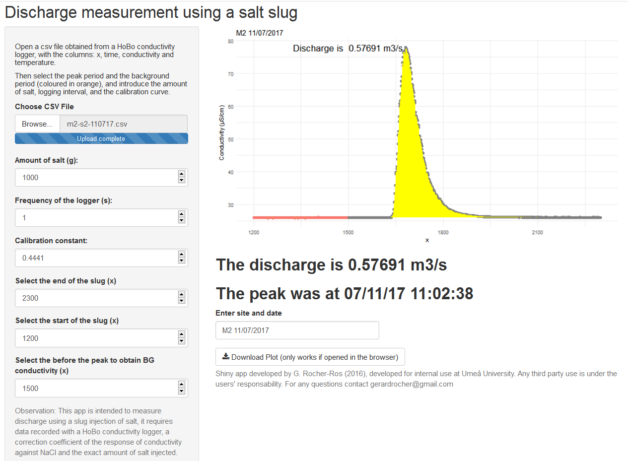
Shiny app to estimate river discharge
App developed in Shiny to measure discharge in streams using a slug injection. Code and more details in github.
This app is intended to measure discharge using a slug injection of salt, it requires data recorded with a HoBo conductivity logger, a correction coefficient of the response of conductivity against NaCl and the exact amount of salt injected.
The version 2 is to use with another method: by adding a measured volume of salt solution in water, with a known conductivity.
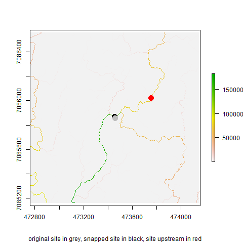
Get river slope anywhere in the world
River slope is a very useful parameter in stream geomorphology, aquatic ecology, hydrology… but hard to obtain easily at any location in the globe. This R script can obtain the stream channel just providing a pair of coordinates of a stream. The workflow is as follows:
- Download a high resolution digital elevation model (DEM) around the site, using the package “elevatr”.
- Model the flow accumulation in the landscape to see the stream channels.
- Snap the coordinates provided to the closest stream.
- An algorithm then follows the stream channel upstream for a predetermined length, and estimates the slope as the elevation difference between the site and upstream divided by the distance.
Code and more details for this is in github.